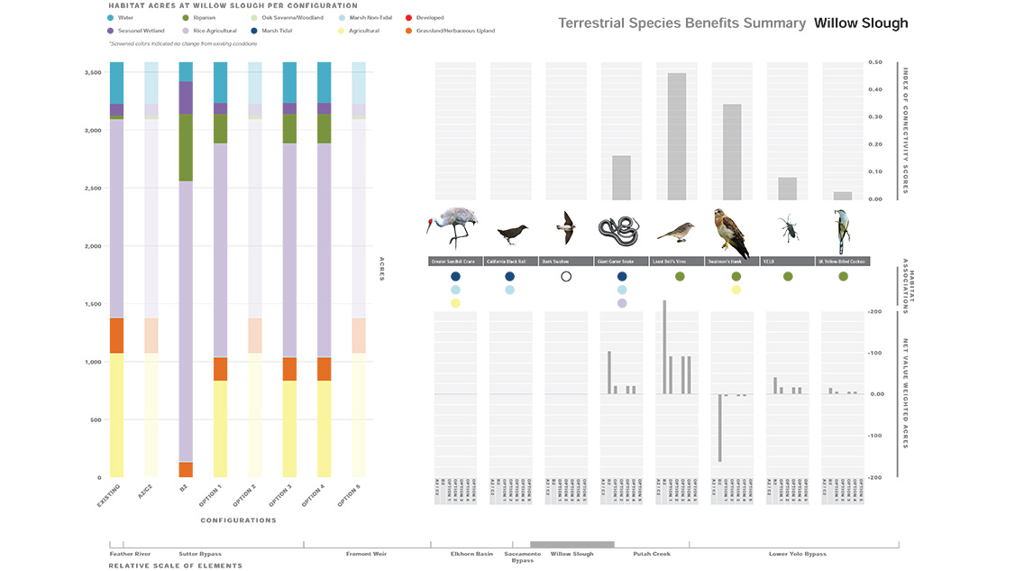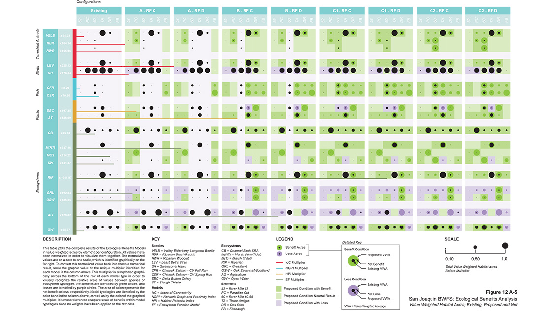
The multi-part model integrates core principles of landscape ecology to quantify the benefits of habitat restoration to species and ecosystems.
Terrestrial Species Model Inputs

Terrestrial Species Model Outputs
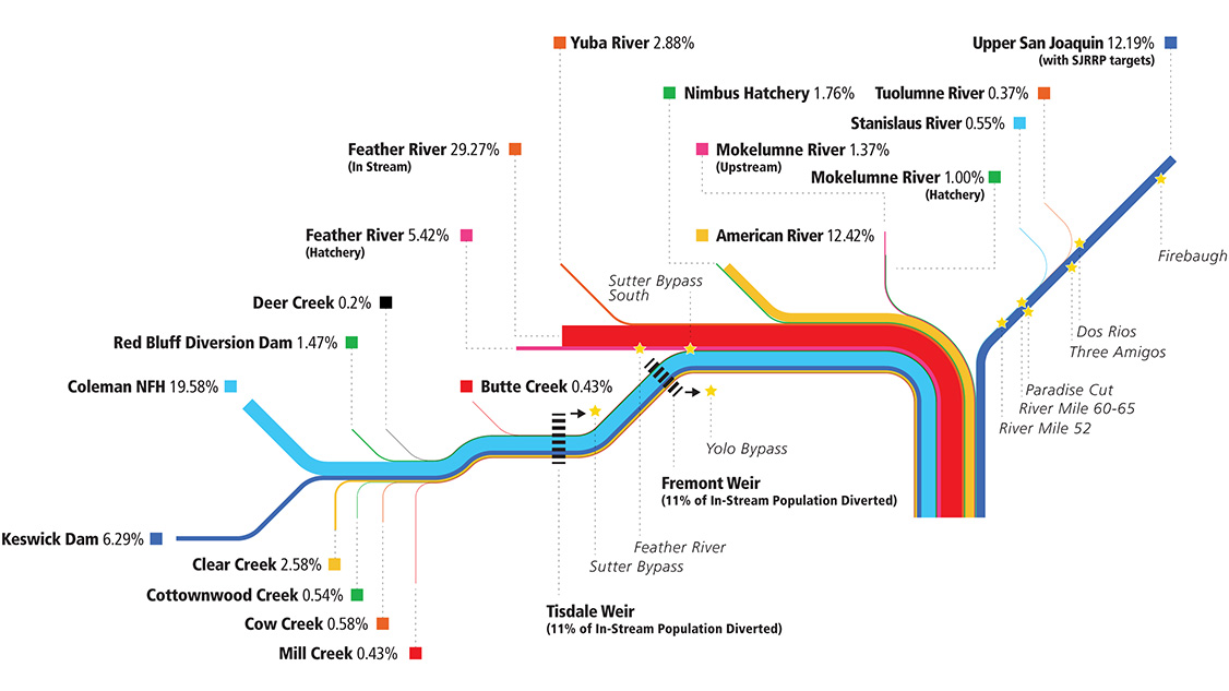
Salmonid Run Accumulation Model
The flood system in California’s Central Valley is among the world’s most extensive human landscape interventions. It comprises 1,500 miles of levees and 200,000 acres of floodways intersecting 18,000 parcel easements. One million people live within the floodplain alongside approximately $70 billion in assets.
Proper management of this flood infrastructure is critical to protecting these communities and assets. Yet, more than half of the levees and floodways do not meet their design criteria or are at a high risk of failure. The state of California Department of Water Resources (DWR) utilizes an integrated solutions approach to flood management which considers a highly diverse range of criteria to ensure that both the system’s performance and the stakeholders’ needs are successfully met.
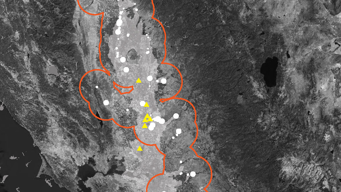
Ecologically, the Central Valley has been dramatically transformed by this infrastructure; the floodplains have been largely disconnected from the rivers, 95% of historical wetland and riparian vegetation no longer exists, 90% of salmonid rearing habitat has disappeared, and there are now 25 associated threatened and endangered species that rely on this shrinking habitat. Therefore, an essential part of DWR’s integrated solutions approach is the restoration of native riparian habitats to support target species and promote ecological function.
Knot co-led the development of a custom ecological model, which helped DWR evaluate numerous options for potential restoration actions throughout the Central Valley and assisted State Level decision-making for project implementation. The team faced a unique challenge when trying to quantify the ecological benefits of these wide-ranging projects; how would similar actions in geographically disparate locations differentially benefit target species identified in the state’s conservation strategy?
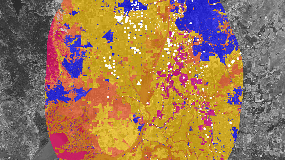
Quantifying ecological benefits may be required to secure federal funding for restoration projects within the flood system. The existing USACE federally-certified models have generally been developed to evaluate specific sites, geographies, or species and weren’t suited for the geographic scale and species diversity encountered in this assessment. Knot developed a two-part model to resolve this critical issue that integrated core principles of landscape ecology to quantify the differential benefits to species partially based on project location. This resulted in sensitive quantified outputs that reflected the proximity of the proposed habitat to key population sources of target species.
To achieve this outcome, Knot evaluated habitat and population connectivity through the application of both least cost path and Circuitscape assessments, combined using an index of connectivity equation developed for this project. Knot’s spatial analysts then used the resulting index of connectivity score to value and weight a habitat acre quality score and sum per action per site. The final result represents a value-weighted acre influenced by the proposed habitat type, quantity, and connectivity to the target species.