Oregon’s ocean-based fisheries and aquaculture are abundant and sustainable, and yet we still import the majority of our seafood from elsewhere. This project collects a powerful concentration of useful data from a range of different sources, putting the tools to explore, analyze, and invest in local food systems into the hands of everyone.
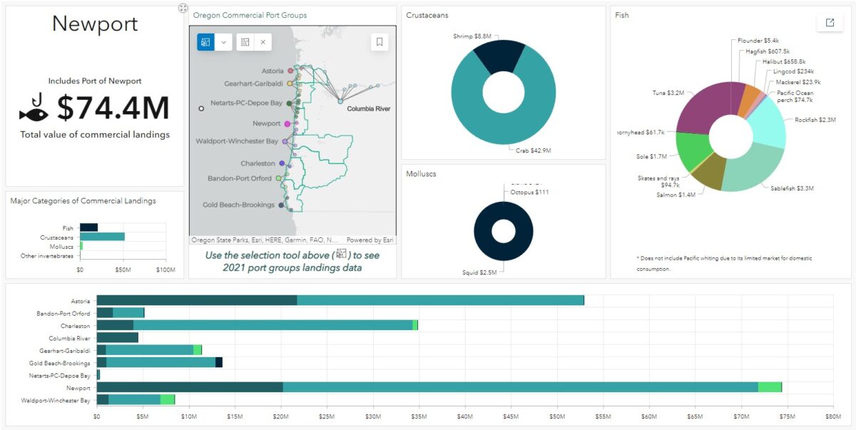
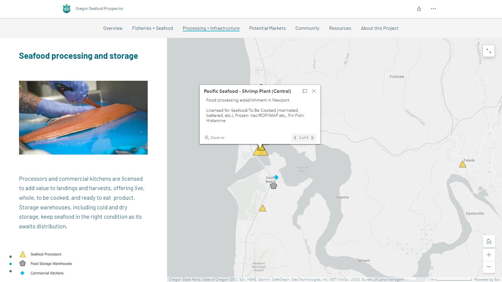
While many datasets related to Oregon’s coastal food economies are publicly available, they haven’t been collected in one place in a legible format, and others are only accessible via public records requests. From commercial landings and estuaries, through critical infrastructure like processors and storage, to the markets and dinner plates, users of the Oregon Seafood Prospector can look for opportunities to grow local, sustainable, and resilient food economies.
This project is critical to the Oregon Coast Visitors Association’s Ocean Cluster Initiative. During its development, copious amounts of data were collected and filtered, presenting and categorizing only the most relevant information with contextual narrative in the Story Map format. Clear map hierarchy and symbology, consistent attribute information, and infographic dashboards offer utility for users from various backgrounds and expertise. The data are also loaded into a standalone interactive map for users who want to work at their own pace, and a source portal links them to where the data comes from.